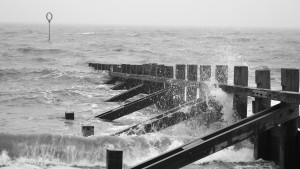
Storm Frank continues to affect much of Scotland

A second meeting of the Scottish Government’s resilience committee has been held, as Storm Frank continues to affect much of Scotland.
The First Minister, Deputy First Minister and portfolio Ministers have been updated on the emerging weather situation and the work underway with local partnerships to co-ordinate the response and ensure at risk areas are as prepared as possible.
Weather warnings are still in place for most of the country whilst almost 100 flood warnings are now in force with the risk of severe flooding in Dumfries & Galloway.
Rising river levels, flash floods and surface water have caused significant disruption to travel networks whilst high winds have brought down trees and disrupted power supplies in some areas.
Police Scotland have this morning issued a stage three alert – for a high risk of disruption – for Dumfries & Galloway, Argyll and Central Scotland.
Environment Minister Aileen McLeod said:“We are dealing with a very serious situation as a result of Storm Frank. Weather warnings from the Met Office have unfolded as forecast and much of Scotland has been experiencing strong winds, torrential rain and rising rivers.
“The Scottish Government’s Resilience Team is closely monitoring the situation which is still developing as persistent rain continues to fall onto saturated ground – and is expected to deteriorate further as river levels continue to rise, even after the rain has stopped.
“It is imperative that people look for and take heed of the latest warnings, information and advice from SEPA, Police Scotland and Traffic Scotland. In particular, consider whether you need to travel and take all possible precautions to stay safe, particularly in the worst affected areas.
“It is clear that people across Scotland are experiencing some challenging situations and the Scottish Government is working closely with local authorities, Police Scotland, SEPA and resilience teams across the country to mitigate the impacts of flooding and the extreme weather we are experiencing.”
Transport Minister, Derek Mackay, said: “We expected challenging conditions today and that has turned out to be the case. Our resilience teams are currently coordinating with partners and agencies in order to ensure that our transport networks remain operational throughout this period of bad weather and we will continue to share latest information between all parties so that we are engaging in an effective and coordinated response.
“I advise anyone travelling to check the local conditions in their area by taking advice from Traffic Scotland or Police Scotland before setting out and to take extra care while on the roads.”
Vincent Fitzsimons, SEPA’s Duty Hydrology Manager, said:“Heavy rain has fallen overnight as forecast. Some areas saw 100 mm in 12 hours, which is an exceptional amount of rainfall, especially over already saturated ground
“The main areas of concern in terms of flood impacts are Dumfries and Galloway, Western Borders Tayside and Grampian and south Highland.
“Reflecting the potential impact from significant river levels upstream and downstream of Whitesands in Dumfries, SEPA has issued a Severe Flood Warning for the Whitesands area. This is being done in consultation with Dumfries and Galloway Council and Police Scotland. We are also keeping the situation elsewhere across the country, for example Deeside, under review.
“More localised flooding, which is expected to affect roads and farmland – maybe isolated properties – across large parts of Central and Southern Scotland, and into North East. The worst of the rainfall has largely passed, but larger rivers will take some time to react as the water moves down towards the sea. Some are reacting now, but in areas like Dumfries the worst of the flooding is expected to co-incide with high tide mid-afternoon today. Rivers further east will take longer to respond. Areas like Callander, Perth, Deeside and Spey areas will continue to see rising levels throughout the day and some will not peak until the 31st.
“However from Friday the situation should start to improve for everyone.
“We would urge people to keep a close eye on Met Office forecasts and on SEPA’s flood updates page which can be found at http://floodline.sepa.org.uk/floodupdates/. There is also some advice on our website about preparing for flooding here http://www.floodlinescotland.org.uk/your-home/
“SEPA staff will continue to monitor rainfall and river levels closely with the Met Office, local authorities and Scottish Government throughout the coming days to keep everyone up to date with the developing picture. Members of the public can also call Floodline on 0345 988 1188.”